Posts

Leonardo da Vinci and the Plan of Imola

Image
  Map making, one of the oldest form of human communications, was a milestone in human history. The earliest maps can be dated back as far as 4th millennium BCE. Needless to say it was in the form of cave paintings. The first map was found in the prehistoric alpine rock carvings of Mount Bego (France) and Valcamonica (Italy). Modern forms of map making, though started much later can be traced back to 1092, in ancient China. Valcamonica rock art But, it is remotely imaginable that a person who is widely renowned mainly as a painter, all over the world, developed a map, which is relevant till date and is taught in architecture schools all over the world. This is no other than Leonardo da Vinci. His map making techniques changed the process from an art form to science. He returned to Florence at the beginning of the 16th Century, after being employed under the Duke of Milan, Ludovico Sforza, for nearly two decades. By that time, da Vinci had already established himself as a scientif...

Carina Nebula and the Mystic Mountain

Image
One of the largest nebulas, the Carina Nebula hosts three other major nebulas within itself. The Carina Nebula (also known as the Grand Nebula , Great Nebula in Carina , or Eta Carinae Nebula ) is a large, complex area of bright and dark nebulosity in the constellation Carina , and is located in the Carina–Sagittarius Arm . The nebula is approximately 8,500 light-years away from Earth . It is one of the biggest nebulas out there. This image shows a view of the giant star-forming region in the southern sky known as the Carina Nebula, combining the light from three different filters tracing emission from oxygen (blue), hydrogen (green), and sulfur (red). The colour is also representative of the temperature in the ionized gas: blue is relatively hot and red is cooler. The Carina Nebula is a good example of how very massive stars rip apart the molecular clouds that give birth to them. The bright star near the centre of the image is eta Carinae, one of the most massive and luminous stars k...

This is the thing with my city : 1

Image
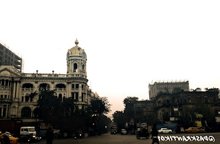
The climate of the tropical region is quite easy to understand. Five seasons. Summer, rainy, autumn, winter and spring come successively. In the recent few years, my city has earned a special tag : "The most polluted city of India". Just like any other tropical region, my city was also used to the successive occurrence of the said seasons. But, in the recent past, things have changed. Why? How did it change? Well, as time goes on, one needs to make a few changes. One needs to remove a few misfits from the society and replace them with new ones.  But due to some strange reason, my city finds it very difficult to adapt with the change. They keep on introducing new things as well as keeping the old ones. Let's take the example of public transport. Here, you can find buses from the mid 90s. You can find buses of the early 2000s, when the Indian transport market was undergoing a revolution, to the latest models. This is not only the case of buses, but also other commodi...

Trek to Chintakphu.

Image
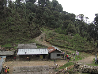
This trek route starts from a place called maimajhuya in Nepal. You have to trek uphill for nearly 18 kilometers. You'll reach this small village( of only 8 to 10 houses) . This village is called gorubale. You'll get to see a lot of birds, and excellent scenic beaty. Youll enjoy the route more than the destination.